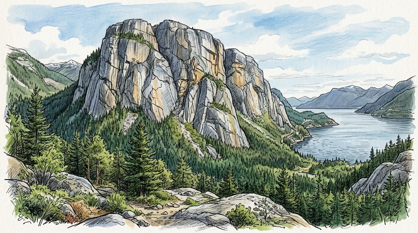
Squamish, at the head of Howe Sound an hour north of Vancouver, is Canada's granite trad capital: the 700 m Stawamus Chief, with its big walls and long crack lines, and hundreds of single-pitch cracks at the Smoke Bluffs right by town. It's on the Pacific coast, so it's one of the wettest climbing areas around in winter, and one of the best in summer. We ran 30 years of weather through our drying model to find out when the granite is most often dry and climbable.
We took 30 years (1996–2025) of daily temperature and rain from Environment and Climate Change Canada's station at Squamish Airport, 11 km north of the Chief, and daily humidity from Daymet, NASA's 1 km weather grid. We used it for two kinds of trad: the quick-drying Smoke Bluffs (south-facing, by town) and the Grand Wall of the Chief (west-facing, and slow to dry when it seeps). Then we ran every day through the climbingforecast drying model, with the same granite rules as our live forecasts. Each day is scored for an afternoon session, and again at the day's low for an early start. Looking for bouldering? See our Squamish bouldering article and the Squamish climbing guide.
When is the best time for trad climbing in Squamish?
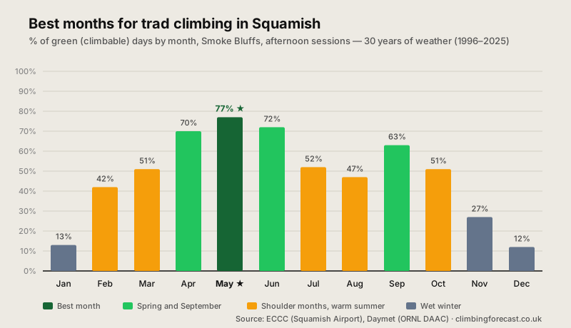
Late spring: May is the best month. At the Smoke Bluffs it scores 77% green afternoons, ahead of June (72%) and April (70%). May reached 70% green in 25 of the 30 years: even a wet May is usually decent. The rain eases quickly through spring, from 259 mm in March to 87 mm in May, and the air is still cool, with highs of 19°C (66°F).
Summer is the driest season, but warm. July gets about 40 mm of rain on only 5 days, the driest month of the year. But afternoon highs reach 25°C (77°F), and the model marks many warm, humid afternoons amber for poor friction, so July (52%) and August (47%) score below spring at the Smoke Bluffs. Mornings are better: on the Grand Wall, July and August mornings score 72–73%, the best of the year on the big walls.
September is a second season. The Smoke Bluffs score 63% in September, as the heat eases before the autumn rains. They arrive in October, which gets 285 mm, and by November it's very wet.
Squamish trad climbing conditions month by month
| Month | Smoke Bluffs | Grand Wall | Grand Wall morning | High | Rain | Rain Days |
|---|---|---|---|---|---|---|
| Jan | 13% | 6% | 6% | 5°C / 40°F | 353 mm | 17.2 |
| Feb | 42% | 23% | 22% | 7°C / 45°F | 191 mm | 13.4 |
| Mar | 51% | 29% | 27% | 10°C / 50°F | 259 mm | 17.0 |
| Apr | 70% | 41% | 39% | 15°C / 58°F | 144 mm | 12.6 |
| May ★ | 77% | 50% | 52% | 19°C / 66°F | 87 mm | 9.9 |
| Jun | 72% | 44% | 55% | 21°C / 71°F | 66 mm | 8.6 |
| Jul | 52% | 41% | 73% | 25°C / 77°F | 40 mm | 5.1 |
| Aug | 47% | 40% | 72% | 25°C / 77°F | 54 mm | 5.4 |
| Sep | 63% | 47% | 56% | 21°C / 69°F | 128 mm | 8.8 |
| Oct | 51% | 35% | 34% | 14°C / 57°F | 285 mm | 14.7 |
| Nov | 27% | 17% | 16% | 8°C / 46°F | 398 mm | 18.0 |
| Dec | 12% | 7% | 7% | 4°C / 39°F | 340 mm | 17.6 |
% of green (climbable) days, 30 years (1996–2025) of daily weather: temperature and rain from Environment and Climate Change Canada's Squamish Airport station, humidity from NASA's Daymet grid. Smoke Bluffs and Grand Wall are scored at the day's high (afternoon); Grand Wall morning at the day's low. High is the average daily high at the Smoke Bluffs, Rain the monthly average (rain and melted snow), and Rain Days the days with 1 mm or more. Factors in rain, drying time, seepage, wind, humidity, snow and heat. Cold, dry days count as green. Contains information licensed under the Open Government Licence – Canada.
The Chief or the Smoke Bluffs?
The Smoke Bluffs dry first. They face south, get the sun most of the day and don't seep much, so they come into condition first after rain and first in spring. From February to May they score 20–30 points above the Grand Wall.
The big walls need a dry spell. The Chief's walls collect water from the ledges and forest above them, and after a wet spell the cracks can seep for days. In spring, our model marks the Grand Wall amber for days after rain while it seeps, which is why it scores 41–50% from April to June. Wait for a run of dry days, and expect wet streaks in the cracks early in the season.
In summer, the Chief comes into its own. By July and August the seepage has dried up, and Grand Wall mornings score 72–73%. The wall faces west, so it's in the shade until the early afternoon: start early and you can climb in the cool before the sun comes round.
Autumn and winter: the wet season
From October, the rain sets in. October gets 285 mm, November 398 mm and December 340 mm, on 15–18 days a month. Squamish gets about 2,350 mm (92 in) of rain a year, nearly four-fifths of it from October to March. Scores at the Smoke Bluffs fall from 51% in October to 12–13% in December and January, and the Chief is mostly a write-off.
February and March bring the first chances. The Smoke Bluffs score 42% in February and 51% in March, when a dry spell can give cool, crisp days on the south-facing walls. The big walls are usually still wet.
Trad climbing in Squamish: what to expect
Splitter cracks in granite. The Chief is a dome of granodiorite, a kind of granite, that rises more than 700 m above Howe Sound. Its walls are split by long crack systems, from fingers to offwidths, and the climbing goes from short cracks at the Smoke Bluffs to long free routes and aid walls on the Chief. The Grand Wall was first climbed in 1961, by Ed Cooper and Jim Baldwin. Bring a full rack of cams, often with doubles.
Parks and closures. The Chief is in Stawamus Chief Provincial Park. Peregrine falcons nest on some walls in spring and early summer, so check for seasonal closures before you go. The Smoke Bluffs are a town park a few minutes' walk from downtown Squamish.
Best: May
77% green afternoons at the Smoke Bluffs, and 70%+ in 25 of the 30 years. April to June is the season.
Big Walls in Summer
July and August mornings score 72–73% on the Grand Wall, once the spring seepage has dried up.
Wet Winter
Nearly 400 mm of rain in November. From November to January, scores fall to 12–27%.
How we calculated this
Environment and Climate Change Canada's Squamish Airport station (51 m) is the Squamish weather station, on the same valley floor as the crags, with a nearly complete daily record of temperature and rain from 1996 to 2025. The few missing days were filled from Daymet, and the temperatures were moved to each crag's height. The station doesn't publish daily humidity, so we used Daymet's daily humidity at the Grand Wall (the bouldering article used monthly averages instead). Using Daymet's rain in place of the station's changes the results by 5 points or less.
Every day is rated on recent rain, drying time, seepage, wind, humidity, snow and heat, at the day's high (afternoon) and low (morning). The model reads the air temperature, not the rock, and doesn't know which cracks are still seeping, so use the numbers to choose your month and our live forecasts for the Smoke Bluffs and the Grand Wall to choose your day.
Data retrieved 8 October 2026. Contains information licensed under the Open Government Licence – Canada: Environment and Climate Change Canada, Historical Climate Data (Squamish Airport, Climate ID 10476F0). Humidity from Thornton, M.M., R. Shrestha, Y. Wei, P.E. Thornton, S-C. Kao and B.E. Wilson (2022), Daymet: Daily Surface Weather Data on a 1-km Grid for North America, Version 4 R1, ORNL DAAC. History from Wikipedia. For more granite trad, see our Yosemite Valley, Bohuslän and Valle dell'Orco guides.
Good luck and enjoy the climbing!